
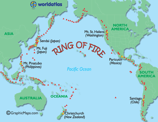
Vành đai lửa Thái Bình Dương là một khu vực hay xảy ra động đất và các hiện tượng phun trào núi lửa . Đôi khi còn được gọi là vành đai địa chấn Thái Bình Dương.
The large series of volcanoes (some active) encircling the Pacific Ocean are referred to as being part of the Ring of Fire, and notorious for frequent earthquakes and volcanic eruptions.
The Ring of Fire, coinciding with the edges of one of the world's main tectonic plates, (the Pacific Plate) contains over 450 volcanoes and is home to approximately 75% of the world's active volcanoes.
Nearly 90% of the world's earthquakes occur along the Ring of Fire; most recently, the devasting quakes in Chile, Japan and New Zealand.
Volcanoes and Earthquakes of note:
Christchurch Earthquake, New Zealand
Mount Saint Helens, Washington, USA
Mount Pinatubo, Philippines
Mt. Fuji, Japan
Paricutin Volcano, Mexico
Santiago Earthquake, Chile
Sendai Earthquake, Japan
http://www.worldatlas.com/aatlas/infopage/ringfire.htm
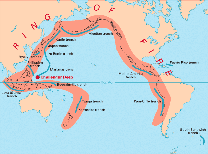
Ring of Fire, Plate Tectonics, Sea-Floor Spreading, Subduction Zones
coi trong :
http://vulcan.wr.usgs.gov/Glossary/P...tectonics.html
Ring of Fire
The "Ring of Fire", also called the Circum-Pacific belt, is the zone of earthquakes surrounding the Pacific Ocean- about 90% of the world's earthquakes occur there. The next most seismic region (5-6% of earthquakes) is the Alpide belt (extends from Mediterranean region, eastward through Turkey, Iran, and northern India.
http://earthquake.usgs.gov/learn/glossary/?termID=150
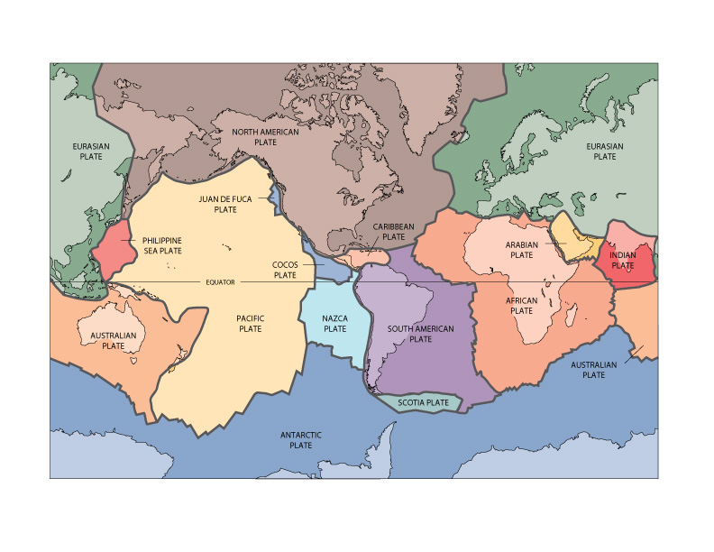
Significant tectonic plates on the earth's surface.
Public Domain from USGS
The layer of the Earth we live on is broken into a dozen or so rigid slabs (called tectonic plates by geologists) that are moving relative to one another.
http://pubs.usgs.gov/gip/dynamic/slabs.html
http://geography.about.com/cs/earthq...ringoffire.htm

 Reply With Quote


Bookmarks