Cộng hòa Liên bang Myanmar
[url]https://vi.wikipedia.org/wiki/Myanmar[/url]
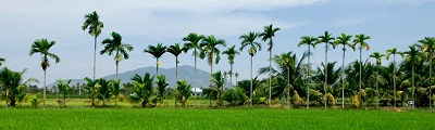
Myanmar (Phát âm tiếng Myanma:[mjəmà], phát âm tiếng Việt: Mi-an-ma, tên gọi cũ: Miến Điện), tên chính thức là Cộng hòa Liên bang Myanmar, là một quốc gia có chủ quyền tại Đông Nam Á có biên giới với Bangladesh, Ấn Độ, Trung Quốc, Lào và Thái Lan. Một phần ba tổng chu vi của Myanmar là đường bờ biền giáp với vịnh Bengal và biển Andaman. Theo số liệu điều tra nhân khẩu năm 2014, Myanmar có 51 triệu cư dân.[2] Myanmar có diện tích 676.578km². Thành phố thủ đô là Naypyidaw còn thành phố lớn nhất là Yangon.[3]
Các nền văn minh ban đầu tại Myanmar gồm có các thị quốc Pyu nói tiếng Tạng-Miến tại khu vực Thượng Miến và các vương quốc Mon tại khu vực Hạ Miến.[4] Đến thế kỷ 9, người Miến tiến đến thung lũng Thượng Irrawaddy, họ lập nên Vương quốc Pagan trong thập niên 1050, và sau đó ngôn ngữ-văn hóa Miến cùng Phật giáo Nam Tông dần dần chiếm ưu thế tại Myanmar. Vương quốc Pagan sụp đổ trước các cuộc xâm chiếm của quân Mông Cổ, và xuất hiện một số quốc gia thường xuyên giao chiến. Đến thế kỷ 16, Myanmar tái thống nhất dưới Triều Taungoo, sau đó từng trở thành quốc gia lớn nhất trong lịch sử Đông Nam Á.[5] Đến đầu thế kỷ 19, lãnh thổ của triều Konbaung bao gồm Myanmar ngày nay và cũng từng kiểm soát Manipur và Assam trong thời gian ngắn. Người Anh chiếm được Myanmar sau ba cuộc chiến tranh trong thế kỷ 19 và quốc gia này trở thành một thuộc địa của Anh. Myanmar trở thành một quốc gia độc lập vào năm 1948, ban đầu là một quốc gia dân chủ, song nằm dưới chế độ độc tài quân sự sau cuộc đảo chính năm 1962.
Trong hầu hết thời gian độc lập, Myanmar xảy ra xung đột dân tộc tràn lan, trở thành một trong các cuộc nội chiến kéo dài nhất vẫn đang diễn ra. Trong thời gian này, Liên Hiệp Quốc và một số tổ chức khác ghi nhận các vi phạm nhân quyền tại đây.[6][7][8] Năm 2011, chính quyền quân sự chính thức giải tán sau tổng tuyển cử năm 2010, và một chính phủ dân sự trên danh nghĩa nhậm chức. Mặc dù các lãnh đạo quân sự cũ vẫn nắm giữ quyền lực rất lơn trong nước, song quân đội tiến hành các bước nhằm từ bỏ kiểm soát chính phủ. Điều này cùng với hành động phóng thích Aung San Suu Kyi và các tù nhân chính trị, đã cải thiện hồ sơ nhân quyền và quan hệ ngoại giao của Myanmar, kéo theo nới lỏng các chế tài mậu dịch và kinh tế khác.[9][10] Trong tổng tuyển cử năm 2015, đảng của Aung San Suu Kyi giành đa số tại lưỡng viện quốc hội.
Myanmar giàu tài nguyên ngọc thạch và đá quý, dầu mỏ], khí thiên nhiên và các loại khoáng sản khác. Năm 2013, GDP danh nghĩa ở mức 56,7 tỷ USD và GDP theo sức mua tương đương đạt 221,5 tỷ USD. Khoảng cách thu nhập tại Myanmar nằm vào hàng rộng nhất trên thế giới, do phần lớn kinh tế nằm dưới quyền kiểm soát của những người ủng hộ chính phủ quân sự cũ.[11][12] Tính đến năm 2014, Myanmar có chỉ số phát triển con người HDI ở mức thấp, xếp thứ 148 trong số 188 quốc gia được đánh giá.
Giấc mơ Đông dương đối với phó với tham vọng của Xì dầu !!!
ngày 07 - 01 2017... trơì nắng to..
cảm ơn quí Bạn đã nhắc tới Giấc mơ Liên bang Đông dương. Trở thành sự thật hay là hay là cơn mê nô lệ ngàn năm cho các tiểu nhược quốc, lãnh đạo bởi những kẻ thiếu tầm nhìn lại vụ lợi cho bản thân hay tập thể nhỏ nhoi.. để đến nỗi mang tiếng " vong bản "!
Với chính sách, chiến lược trường kỳ, của kẻ mạnh, đám cầm quyền tuân lệnh; từ chiều chuộng o bế đến ra tay đàn áp để cố quàng cái gông lên cổ của những người dân, miễn sao có lợi cho đám cường quyền, lợi ích phe nhóm.
Ngày xưa, Xì dầu đã làm thành con đường tơ lụa 1 xuyên qua Tây vực, Trung Á đén cận Âu châu.. thành hình phát triển, rồi đến con đường gốm xứ.. ngược hướng đi ra đông bắc Thái bình dương.. và nay thì đến con đường tơ lụa 2 trên biển trải dài từ Tây Á; vòng từ Miến điện, Ấn độ dương xuống phía nam vòng qua trước mặt Úc châu sang Biển Dong tới Nhật bản..
Ngày hôm nay mới có tin thêm một cảng biển ở SriLanka được Xì dầu cộng tác phát triển, không biết hai phe nào đã nổ súng trong khi tranh chấp nội bộ.. Tóm lại.. Thử nhìn xem Xì dầu đã có được bao nhiêu cảng biển ở Tây Á ;
1./.. Gwadar- Karachi/ Pakistan
2./ . Colomba Hambantota/ India
3./. Nongla- Chittagon ? Ấn-Miến
4./. Pyankapyggu / Miến
5./. Kok Kong / Cambodge
6./. KonSdach / Cambodge
7 ../ Sihanoukville / cambodge
8./. Kuangtan- Singapore
9./. Tạnungsanh / Ma lai
10/. Klang port / Kula Lumpur/ Mã lai
... và còn thiết lộ tiếp nối, song song cùng thuỷ vận dự án 17,7 tỷ ÚSD của Mã lai tự mình , hay Xì dầu góp vốn đầu tư ?
Khi con kênh đào Kra- Thailand thành hình thì tuy vận chuyển chỉ rút ngán được khoảng 7 ngày và đường dài ngắn đi cũng cả ngàn cây số. Cái vùng Nam Á sẽ đi về đâu ?.. vì biển Đông hầu như nằm trong tay Xì dẩu ?
.. số phận Hoàng sa, Trường sa, Phú quốc.. cũng như nước Việt nam, Cam bốt, Lào, ngay cả Philuattan sẽ thành một nước hay quận huyện của cường quốc nào ?? có còn cái tên của tổ tiên để lại hay không ?.
Phải chăng đó là hậu quả nhãn tiền ?? phải chăng vì ngu muội, hay vì cái danh, cái ( tôi!! chia rẽ Việt Mên Lào ) mà bỏ lỡ thời cơ khi đã đến trong tay , hay vì chút bổng lộc quyền lực đã làm cho mờ mắt ?
Tiếc cho sự đã rồi ! bây giờ quay sang xứ Cao bồi, hay xứ Kimono.. hay nước nào chăng nữa !; để năn nỉ ỉ ôi..mè nheo giúp đỡ...
.. chờ được mạ(mẹ); thì má đã xưng !! ./. Buồn ơi ! Chào mi ..